Texas Tree Trails© |
|
|
|
Dallas Arboretum and Botanical Society Champion Tree Trail
|
|||||||||||||||||||||||||||||||||||||||||||||||||||||||||||||||||||||||||||||||||||||||||||||||||||||||||||||||||||||||||||||||||||||||||||||||||
|
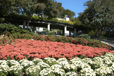
A champion tree is defined as the largest of its species within a given region. Our region is defined as that geographical area shown in the map on the Maps and Trails page where registered Champion Trees range from regional to state and even national. The Dallas Arboretum and Botanic Society Gardens located at 8525 Garland Road Dallas, Texas 75218 was opened to the public in 1984. The Dallas Arboretum, one of the finest show gardens in the Southwest, is alive with color year-round. What may not be so obvious is the groundbreaking research that is done at the Arboretum, which is a testing grounds for new plants to be used throughout the United States. It is home to nine large feature gardens, eleven specialty gardens, visitor amenities throughout and the twenty-one champion trees accessible on the exquisite, easy-walking trails which allow close-up viewing and photographic opportunities most of which are wheelchair accessible. This particular tree trail is on public land so it can be visited personally by you and your family or school group. The interactive Windows Live Earth map to the trees is shown below. The total walking distance including all three tree trails is over 2.5 miles so it may take some time to complete the tour. For those who can't make the walk, for those who just want to take it easy and for a public record, we provide this Virtual Tour. InstructionsTo begin the DABS Virtual Tour, click on the #1 pin on the map below. This pin is the start point of the blue line to the left (West). It coincides with the #1 tree in the Tree Details list on the left, the Chinese Persimmon. Clicking a pin displays pop-up balloons with the tree name and tree number so you may find them on the Tree Detail list on the left-side of the map. Clicking the Tree Name on the Tree Detail list (on the left) will display botanical, physical and photographic details of the chosen tree in a pop-up window. Each numbered tree stop (push-pin) along the tour will have its own corresponding web page with photos, measurement data and botanical information for the tree at that location. Click the red pin, read the Tree Name on the pop-up balloon and click the corresponding Tree Name on the Tree Detail. That's it. The Windows Live Earth map is live and interactive. You can zoom-in and zoom-out, move to another location by scrolling with your mouse or keyboard and select map or aerial photo views. You are your own tour guide and can return to the tour depot (the parking lot), visit the next tree or visit the previous tree at any time without getting your shoes muddy. So sit back and enjoy the tour. Note: The blue line is drawn in a linear fashion from tree to tree. Garden rules specify you must stay on the trail, so make sure you get a map at the entrance when you arrive to track your location and find the closest trail that will take you around to the next tree on the tour. Walking Tour DirectionsSince the trees are on city owned park land, the public can visit the trees within park operating hours. Dallas Arboretum and Botanic Society Garden information and maps maybe downloaded or viewed from their web site. Start your tour from the Main Entrance gate. Get an arboretum map from the ticket booth when you first enter. Then get a satellite fix on a map landmark close to the gate to begin your tour. You are never very far from a listed tree. The following GIS latitude and longitude values are for those adventurous folks with portable GPS units that want to "geo-trek" through the gardens pointing out the trees. |
|
||||||||||||||||||||||||||||||||||||||||||||||||||||||||||||||||||||||||||||||||||||||||||||||||||||||||||||||||||||||||||||||||||||||||
|
 As with the other arboretum type trails, each tree of the Dallas Arboretum and Botanic Society (DABS) Champion Tree Trail may not be a large tree as you would think a really large tree to be, but each are registered champions. Some are quite large, relatively but some are actually shorter than the average human.